At the north and west, the high alpine mountains of the Wasatch Plateau slope down eastward into desert country of sagebrush, pinyon and juniper. The Price River, which gets its start on the plateau, cuts through Castle Valley.
To the east is the rugged and remote Tavaputs Plateau. The Book Cliffs, part of the plateau, stretch 200 miles from Utah into Colorado. The Green River cuts through the plateau, forming the beautiful, Grand Canyon-like Desolation Canyon at the west end of the county.
Geographically, Carbon County is in the Colorado Plateau physiographic province.
First Peoples
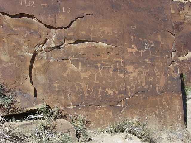
The Fremont people thrived throughout this region about 1,000 years ago. They left many echoes of their lives—in finely formed Fremont figurines, rock art such as those in Nine Mile Canyon and the Gordon Creek area, pithouses and granaries such as those in Range Creek.
Settlers
The high Wasatch Plateau was a formidable barrier to settlement in Carbon County. Routes into the region included offshoots of the Old Spanish Trail and a trail over Soldier Summit. But it wasn’t until the late 1870s that Mormon settlers arrived to establish farms, ranches, and towns along the Price River.
At the time the settlers were living in Emery County. But in 1894 the territorial legislature split the county, creating Carbon County.
In early generations, most people farmed and ran livestock, giving Carbon County a tradition of cowboys—and outlaws, too, with the likes of Butch Cassidy and Gunplay Maxwell roaming the area.
During the early years, the Nine Mile Canyon freight road from Price to the Uinta Basin became an important transportation route.
Coal, Coal, Coal!
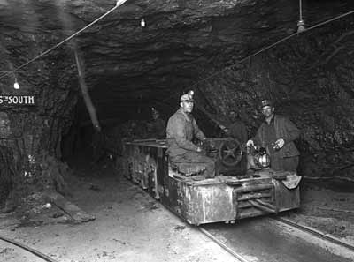
During the early 1880s, the Denver and Rio Grande Western Railroad, looking for a route from Denver to Salt Lake City, discovered vast coal fields in Carbon County. Coal mining became a big part of the county.
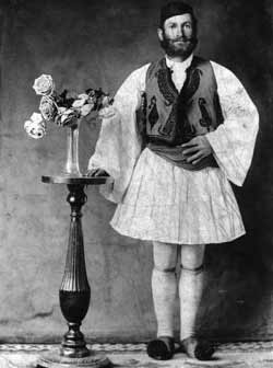
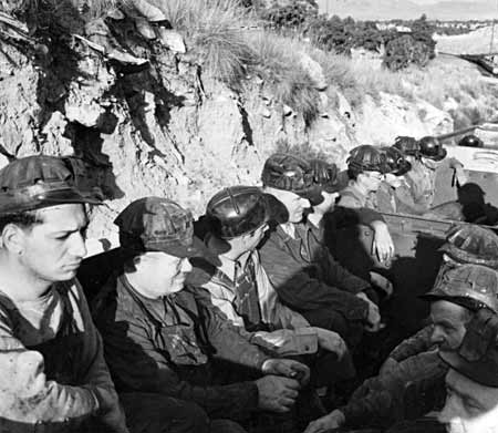
Coal companies built lots of company towns. They brought in southern and eastern European and Japanese laborers to work in the mines and on railroad gangs. Helper became known as the town of “57 Varieties” because of its ethnic diversity.
Mine explosions near Scofield in 1900 (200 killed) and at Castle Gate in 1924 (172 killed) and major strikes in 1903-4, 1922, and 1933 brought tragedy, violence, and eventual unionization to the mines.
Economy
Coal mining continues to play a vital role in economic and social development, with ups and downs in the industry creating periods of boom and relative bust.
Utah Power and Light built a main electric generating plant near the former town of Castle Gate. In 1980 the Carbon Plant generated 171 megawatts of electricity. Ninety-eight percent of UP&L’s power comes from coal-burning steam plants.
Utah State University Eastern, formerly College of Eastern Utah, established in Price in 1937, has become part of what drives the county’s economic and social development.
Did You Know?
| Nine Mile Canyon is the location of Fremont rock art. It is often called the world’s largest art gallery. |
| People from dozens of nations work in the county’s coal mines |
| Butch Cassidy and Elza Lay Stole stole $8,000 in wages from the Pleasant Valley Coal Company in 1897 |
| Helper, Utah, is named after helper engines used on trains going up the steep mountainsides in Price Canyon |
| Mining accidents have led to the deaths of many people. Two mining accidents include the Winter Quarters explosion (1900) and the Castle Gate explosion (1924) |
Fast Facts
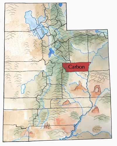
Area: 1,476 square miles
County Seat: Price
Name: Due to the vast amounts of coal found in the region
Main Cities and Towns: Price, Helper, East Carbon, Wellington
Keep Exploring!
Return to the County’s home page here.
Return to the I Love Utah History home page here.