Sevier County lies in the High Plateau country of central Utah. Most of the towns lie near the Sevier River in an arid valley, which has been made fertile through irrigation.
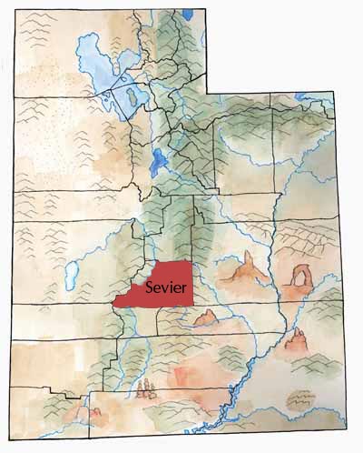
Mountain ranges border the valley: the Pahvant Range and Tushars on the west and Wasatch and Fish Lake plateaus on the east. National forests cover almost half of the land. The beautiful Fish Lake, high in the Fishlake Plateau, is the source of the Fremont River.
The Sevier River flows through the county and has been a source both of life-giving water and of destructive floods.
Much of the rocky landscape comes from volcanic action. And the earth is still moving: four major faults in the county have slipped and caused lots of earthquakes.
First Peoples
Many ancient Native American sites have been found in the county.
The earliest people, Paleoindians, were followed by Archaic Period people. Sudden Shelter, an Archaic site on Ivie Creek, contains one of the longest cultural time records in Utah east of the Wasatch—from 7,080 to 90 years ago.
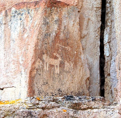
People continue to find Fremont culture sites, especially during construction projects. During the building of the I-70 freeway, crews uncovered a very large Fremont village in Clear Creek Canyon called Five Finger Village. Today, Fremont Indian State Park preserves artifacts and rock art from this village.
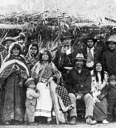
Southern Paiutes lived in the area when the first non-native people came through. Peaceful, with no guns or horses as their cousins the Utes had, the Paiutes suffered when bands of Utes stole women and children to trade as slaves.
Exploring and the First Wave of Settlement
Travelers on the Old Spanish Trail and mountain man Jedediah S. Smith were among those who crossed the county before white settlement. The Mormon Parley P. Pratt Exploring Expedition came through during the winter of 1849-50, and George W. Bean explored Sevier Valley in 1863.
Early in 1864 some men from Sanpete came to the Richfield area to live, drawn by the soil, water, and tree cover. A few months later, 30 families, “called” by LDS church leaders to settle there, joined them. In 1865, 100 more families came. They founded towns and built a schoolhouse.
The loss of their land and food sources frightened and angered the American Indians, and the violence of the Black Hawk War swept through Sevier County. Settlers and Indians killed each other. Finally, in 1867, the Mormon leaders counseled the settlers to leave the valley.
Second Wave of Settlement
White settlers didn’t begin to return until 1870, after Black Hawk and most of his fighters had surrendered.
Many of the county’s early settlers were Scandinavians who brought distinctive building styles and cultural practices with them.
Development
The area grew rapidly. Richfield, with 8 families and 12 men in 1871, had 753 people by 1874 and was on its way to eventually becoming a major regional commercial center and, eventually, the provider of hospital, airport, and other services for a large area.
When the Deseret Telegraph extended its line from Gunnison to Monroe in 1872, it provided a vital communications link between Sevier County and the rest of the territory.
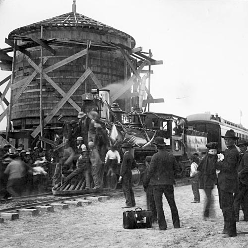
The Denver & Rio Grande Railroad reached Salina in 1891 and Richfield in 1896. The railroad helped Sevier’s farmers transport and sell their products more easily. The next major leap in transportation came with the building of Interstate 70 in the 1980s. Now Sevier was linked with the national freeway system.
German Prisoners of War (POWS)
During World War II, Sevier County had the unique experience of hosting 250 German prisoners of war in a POW camp in Salina. The prisoners had been sent to help sugar beets and do other farming work.
One tragic night as the Germans slept in their tents, the American guard opened fire with a machine gun, raking the tents and killing nine prisoners. The German soldiers were buried at Fort Douglas Cemetery with military honors.
Economy
Today, sheep and cattle remain important to the local economy, as do dairy products, field crops, and, in recent years, turkey raising.
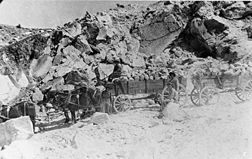
Trade and manufacturing—including food processing, clothing, and building products—contribute to the county as well. Sevier is the state’s leading producer of gypsum—and a factory in Sigurd uses this mineral to produce plaster and plasterboard for buildings.
The county also has coal mines and natural gas reserves in the northeast. Its major geothermal resources could be tapped for energy production.
Did You Know?
| In 1908 a gypsum plant was built near Sigurd. Plaster and wallboard have been important county products. |
| In 1957 the county had an election to vote on paying $50,000 for equipment to bring TV to the county. TV won 3 to 1. |
| Repeated volcanic explosions helped form the land. Geologist Clarence Dutton first noticed this. He surveyed the land in 1875, 1876, and 1877. |
| Big Rock Candy Mountain, in Marysvale Canyon, is colored vivid yellow and maroon. A train man wrote a famous song about the mountain, and Wallace Stegner wrote a book with that title. |
| In 1921 a dozen earthquakes hit the county. |
Fast Facts
Area: 1,976 Square Miles
County Seat: Richfield
Where it Got its Name: Sevier River
Main Cities and Towns: Richfield, Salina
Economy: Livestock, Manufacturing, Trade
Keep Exploring!
Return to the County’s home page here.
Return to the I Love Utah History home page here.