Emery County is in the Colorado Plateau province—and it includes three different kinds of landscape. The high, cool, forested mountains of the Wasatch Plateau rise to the west. Along the base of the plateau lies Castle Valley, with its farms, ranches and settlements.
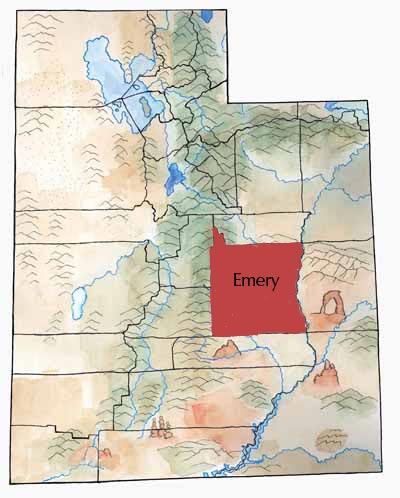
But desert country takes up most of the county. This desert has many variations: the rugged and fantastical San Rafael Swell, the rock hoodoos of Goblin Valley, slot canyons, wide stretches of land west of the Green River, Cedar Mountain, and more.
The county’s lifeblood—the San Rafael River—begins in the Wasatch Plateau. There, several reservoirs store its headwaters for agricultural and industrial use. Three creeks—Huntington Creek, Cottonwood Creek, and Ferron Creek—flow from the Plateau into Castle Valley and join to form the San Rafael River. The river then twists its way through the canyons and desert to its junction with the Green River.
Emery County is a big land, but it was once much larger. But the state legislature split off Grand County in 1890 and Carbon County in 1894.
First Peoples
People have lived in the San Rafael region for thousands of years. The Archaic culture evolved into the Fremont culture, which lived in the area until about A.D. 1300.
Indigenous peoples left behind many pictograph and petroglyph panels, in places such as Temple Mountain Wash, Muddy Creek, Ferron Box, Black Dragon Canyon, and Buckhorn Wash—all sites listed on the National Register of Historic Places. Later, Ute Indians occupied sites in Castle Valley.
Settlers
In the 1830s and 1840s, travelers along the Old Spanish Trail passed through the present county.
For several decades, settlers concentrated on the “easier” places in Utah. This remote region didn’t attract much attention.
But as Sanpete County became overgrazed, and as settlers claimed much of the water and land, livestock owners brought their herds over the Wasatch Plateau into the county for winter range.
It wasn’t until 1877, though, that settlers began to move in for good.
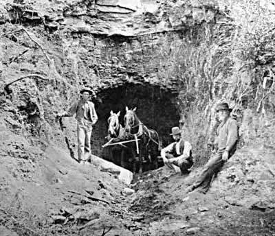
That year Brigham Young wrote a letter to the Mormon church leader in Sanpete County and asked him to send 50 families or more to settle in Emery County. (Young died shortly after he wrote the letter.) Many families responded and moved into Castle Valley to take up homesteads and develop settlements.
Elizabeth Jackson Reid came with her husband. She later wrote:
There were only three other women on Cotton Wood Creek and two of them were Danish and could not speak English and we were all so far apart. . . . Such a barren desert to come to. . . . It almost made me heart sick and does to this day to look back and think of what it was then. Six small children and two hundred miles in everey direction to get to civilization with an ox team.”* *Quoted in A History of Emery County, by Edward A. Geary, page 68.
At first, the family lived in a dugout house with a brush roof.
During the 1970s Emery County’s population grew a lot—from around 5,000 in 1970 to 13,000 in 1983. This was during the time of an “energy crisis” in the United States—so energy development led to “booms” in areas with fossil fuels.
Coal and Power
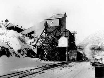
In response to the energy crisis, during the 1970s Utah Power and Light Company built two large power plants and a reservoir in the county. Also, large coal mines opened or geared up to provide coal for the mines.
Officials in charge of providing services scrambled to make sure there was enough water, schools, landfills, roads, and other services for all the newcomers.
After the construction ended, however, the population and employment fell, and hard times returned.
Land Battles
In recent years, scenic lands of Emery County have gotten attention from people who would like to see them gain additional protection. As is usual in Utah, this topic sparks strong emotions among people who disagree on how these lands should be used.
Missiles and Melons
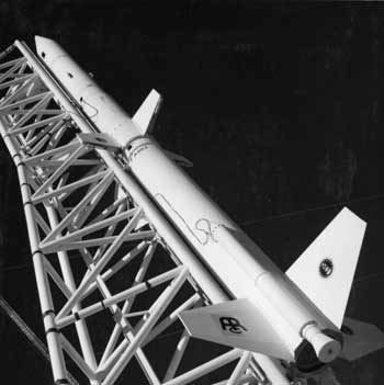
For 15 years, a missile launch complex near Green River boosted that city’s economy and population. But the missiles stopped flying in 1979. More recently, the town of Green River has become well-known for a product grown there for decades: melons. Thousands of melon fans look specifically for Green River melons during late summer.
Economy
Although livestock and farming remained the mainstay of the county’s economy through most of its history, two big developments changed things quite a bit:
1) In 1883, the Denver and Rio Grande Western Railroad came through the county.
2) Coal mines opened at Scofield, Castle Gate, and Sunnyside in Carbon County by 1895.
This meant that farmers could ship out produce and livestock on the railroad. Also, they could sell produce and livestock to feed workers in the mines. And some Emery residents chose to work in the mines during the winter and farm during the summer.
The railroad also led to the transformation of the town of Green River from a little mail station to an important town.
Did You Know?
| The San Rafael Swell has amazing rock “castles,” buttes, and canyons. The first Mormon settlers didn’t arrive until 1877. |
| Workers on the Huntington Reservoir dam discovered bones of a Columbian mammoth in 1988. This mammoth lived more recently and at a higher elevation than any other mammoth found so far. |
| Between 1964 and 1979, the Utah Launch Complex, a missile base near Green River, assembled, tested, and fired missiles toward White Sands, New Mexico. |
| A fire in the Wilburg Mine killed 27 coal miners in 1984. |
| Collapses in the Crandall Canyon Mine killed six miners and three rescue workers in 2007. |
Fast Facts
Area: 4,439 Square Miles
County Seat: Castle Dale
Where it Got its Name: Territorial Governor George W. Emery
Main Cities and Towns: Huntington, Castle Dale, Ferron, Orangeville
Economy: Electric power generation, coal mining, livestock
Keep Exploring!
Return to the County’s home page here.
Return to the I Love Utah History home page here.