Grand County is classic Colorado Plateau country. In the north lie sparse deserts and the rugged Book Cliffs. The spectacular Gray Canyon and Labyrinth Canyon of the Green River form the county’s western edge.
In the southern half of the county, rivers and streams have eroded ancient beds of sandstone and limestone into huge canyons, small canyons, and washes. Wind, weather, and water have sculpted the rock into arches, buttes, and fantastic formations.
The tall, forested LaSal Mountains rise up in the southeast.
First Peoples
A petroglyph of a mammoth or mastodon on a canyon wall west of Moab may indicate that Paleoindian people were in Grand County up to 12,000 thousands of years ago.
At least 5,000 years ago, the Archaic culture emerged. They left traces of their lives in remnants of their homes and tools and the haunting Barrier Canyon-style pictographs they painted on cliff walls.
The earliest form of the Ancestral Pueblo culture emerged about 2,000 years ago. Grand County is as far north as these Pueblo people lived. In fact, the county roughly divided the Pueblo culture and Fremont culture. The Fremont lived mostly north of the Colorado River, and they left behind a lot of evidence of their lives. Much of this evidence still needs to be studied!
Both the Puebloans and Fremont disappeared from Utah by 1300 BC. Utes and Paiutes became the main people to use the land. Today the remains of cliff houses and rock art in the canyons delight explorers. They can delight your grandchildren for many years to come if today we are careful not to touch them, walk on them, destroy them, or take anything. Learn more about how to be nice to archaeology here.
European People Passing Through
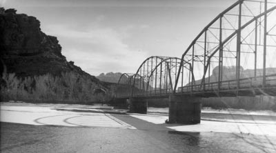
The first non-Indians to enter the present area of Grand County may have been Spanish explorers who discovered a crossing of the Colorado River at the site of the present highway bridge at Moab.
Later, Spanish traders and American fur trappers developed the route known as the Spanish Trail. This trail used that same Colorado River crossing. It crossed the Green River near the present-day city of Green River, Utah.
Settlers
The first attempt by Mormon colonists to settle the Moab area was a failure. A group of men called the Elk Mountain Mission reached Moab Valley in 1855 and planted corn and melons.
It wasn’t long before the Utes who already lived there realized that having the new people around wasn’t working out so well. The Utes attacked the little fort and killed some people—and the missionaries gathered up what they could and got out of there.
The Utes may have won a battle, but they lost the war. In the 1870s various people like cattle ranchers, prospectors, and homesteaders began to trickle in again. Moab became a rough frontier town.
Other small towns were born, and some died. Because the Denver and Rio Grande Railroad built tracks through the county in 1883, several of these towns served the railroad—for instance, Thompson, Cisco, and Crescent Station.
Economy
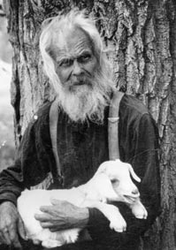
Most of the history of Grand County has been the story of livestock or small family farms and orchards. Large sheep and cattle companies found lots of feed forage for their livestock in the canyons and the LaSal Mountains—at least, until the canyons became overgrazed.
Cowboys and outlaws figure prominently in the area’s folklore.
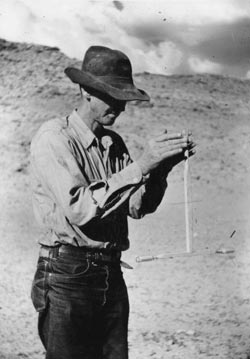
The uranium boom of the 1950s brought the first real surge in population. It also saw the creation of a few large fortunes—as well as many failures.
A big potash mine and plant near Moab have been important to the economy. Sadly, an explosion in the mine—which was at the time the deepest in the United States—killed 18 miners in 1963.
Most recently, tourism has been the county’s biggest source of income. The government created Arches National Monument in 1929. In 1971 it got National Park status.
Visiting mountain bikers, river-runners, and four-wheel-drivers began to transform Moab in the 1980s. The town has gone from a quiet, fading place to a bustling center of motels, restaurants, and stores, jammed with tourists during much of the year. With every passing year, Moab and the main attractions in the vicinity seem to get more popular and crowded.
Did You Know?
| In the 1950s the Atomic Energy Commission paid high prices for uranium, and this fueled a uranium boom. During this time, the county population grew by 300 percent. |
| The Pinhook Battle of 1881 took place in the La Sal Mountains |
| The first permanent non-Indian settlers were cattle ranchers. |
| “Sagebrush Rebels” tried to bulldoze a road into a Wilderness Study Area in 1979. |
| Tourism including river running, Arches National Park, and mountain biking bring people to the county every year |
Fast Facts
Area: 3,689 Square Miles
County Seat: Moab
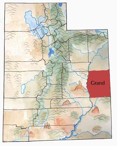
Where it Got its Name: The Colorado River that flows through the county was once called the Grand River.
Main City: Moab
Economy: Tourism, mining, livestock
Keep Exploring!
Return to the County’s home page here.
Return to the I Love Utah History home page here.