Millard County doesn’t get much rain. So the flat areas have alkaline soil and sparse vegetation—except where water from the Sevier River makes alfalfa fields green and lush.
Even many of its mountain areas have sparse vegetation. Going west from the Pahvant Range at the east of the county several mountain ranges rise up above the flat desert. When Lake Bonneville covered the county (the high-water mark of the lake was 18,000 years ago), these mountains were islands in the lake.
Millard County also has large lava beds, volcano cones, and beds of fossils in rocks laid down by ancient seas.
The Sevier River ends at Sevier “Lake.” Most of the time, whatever water is left from irrigation sinks into the alkaline soil, and the lake is just a dry, flat, barren bed.
First Peoples
It wasn’t easy to thrive in this county. However, in PaleoIndian times the climate was cooler and wetter, and they could find a lot of plants and animals in the marshes and shorelines of Lake Bonneville.
After Lake Bonneville shrank to the Great Salt Lake size, the Archaic culture developed and lived on the land for 10,000 years. These people moved around a lot during the year in pursuit of the foods and other resources they needed.
Around 500 BC, the Fremont culture developed in the county. They built pithouses, but also in flat terrain, like in the Pahvant Valley, they made structures from adobe. At Pharo Village, south of Scipio, they built a little village of pithouses near a creek. One or two extended families probably lived in this thriving little place. After the Fremont cultures changed, Goshute, Paiute, and Ute lived in Millard County.
Utah Native Americans
Traditional lands of Goshute, Paiute, and Ute people came together in Millard County.
The Paiutes built cone-shaped shelters called wikiups. Men hunted large and small game; women gathered, grew, stored, and prepared food. They dug bulbs and picked berries. They used pinyon nuts, which grow abundantly in the county. Later, the Paiutes shared their life-saving knowledge with the Mormons.
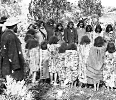
Goshutes lived in the northwest part of the country. They knew how to live in the desert, using seeds, insects, rabbits, rodents, lizards, and large game.
The Utes ranged through much of the county, overlapping with the Paiutes and Goshutes. They lived in small bands and also traveled around to find the things they needed.
Obsidian and Trade
Native peoples from the earliest to historic times used the obsidian found around Black Rock to make tools, especially spear and arrow points. Because of the obsidian—which is rare in the Southwest—there were probably several Indian trade routes that came through the county.
Later, the Old Spanish Trail came through the county. As more and more white people traveled the trail, some captured Paiutes and carted them off to sell as slaves in California and Santa Fe.
Settlers
Before settlement, a few Mormon parties had traveled through Millard County and found that the place seemed like a good place to settle, with good grass and water and friendly Utes living there.
So, at the direction of Brigham Young, in October 1851 two groups left Salt Lake City for east Millard County. Some 30 families led by Anson Call were to make the first permanent white settlement.
They settled at Chalk Creek at the site of Fillmore today. Soon, they received a visit from Kanosh, a leader of the Pahvant band of Utes, who told them that he wanted to settle down and learn better ways of farming. Kanosh became a good friend of the Mormons.
The Capital
The other group that headed to Millard County in 1851 included territorial officials, including Gov. Brigham Young and surveyor Jesse W. Fox. This group needed to select a site for the capital for the new Utah Territory. Fillmore was near the geographical center of the territory (which included all of Nevada, a good chunk of Colorado, and part of Wyoming). So it seemed like a good choice.
Actually, it turned out to be a crummy choice. Even though the settlers built a nice capitol building in Fillmore and the legislature met there a few times, Fillmore was just too far away from where things were happening. So in 1856, the legislature moved the capital to Salt Lake City.
The Gunnison Massacre
In October 1853, Lt. John W. Gunnison was leading a government party looking for a route for a transcontinental railroad. On October 26 the team was camped on the Sevier River near the shores of Sevier Lake when a group of Ute warriors attacked and killed Gunnison and seven of his men.
This happened during the frenzy of the Walker War. Apparently a Ute named Moshoquop and his friends had wanted to kill some whites, because some emigrants passing through had killed Moshoquop’s father.
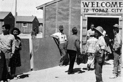
Japanese Internment
During World War II the federal government forced 110,000 Japanese Americans to leave their homes on the West Coast and move to special camps. Crews threw up flimsy barracks on a dry, windy spot outside Delta, strung a tall barbed wire fence around it, and built guard towers around the edge.
During the war 8,700 of these Japanese Americans were imprisoned here. During these years, Topaz, as the place was called, was by far the largest “city” in Millard.
After the war, people in the county moved many of the barracks onto their farms to use for outbuildings and dwellings. Today only cement foundations remain on the site.
Economy
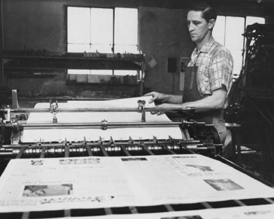
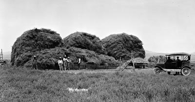
Ranching and farming developed slowly. In the early 20th century Millard was second to Tooele in the number of sheep on its ranges. Later, cattle became the major livestock in the county. The establishment of the Union Pacific line through west Millard County and the founding of Delta in 1907 led to the most important agricultural development: large-scale alfalfa seed production. Eventually, Millard County was producing three-quarters of the state’s crop. The Yuba Dam and other water projects made this venture possible.
In the early 20th century, homesteaders came to Millard County from places like Nebraska and California, lured by free federal land and descriptions of rich agricultural land. Land and water companies developed land and irrigation systems.
But the dreams didn’t go very far. Water was scarce; the soil was poor. Many homesteaders gave up and left. Mining and smelting have contributed to economic growth. Millard produces significant amounts of fluorspar, copper, manganese, sulfur, gypsum, beryllium, and salt.
The most important industrial development, however, began in the 1970s when plans were made to build a huge coal-burning plant near Delta. The Intermountain Power Project generates a lot of electricity—and sells it mostly to Southern California.
Did You Know?
| Cove Fort, built to protect the telegraph, mail, and travelers in 1867, was never needed for protection from Indians, but it was used as a way station. |
| Sally Kanosh, a Bannock Indian raised as Brigham Young’s servant, became the wife of Pahvant Ute chief Kanosh. |
| 9,000 people of Japanese ancestry were removed from their homes and forced to live in an internment camp called Topaz. |
| Beryllium, used in space vehicles and jets, was discovered in the 1950s. Beryllium became important in the county’s economy. |
| Billy Van created incredible, wacky folk art in a dance hall in Delta. |
Fast Facts
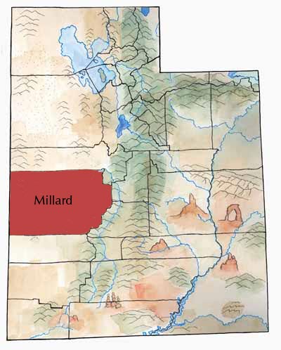
Area: 6,818 Square Miles
County Seat: Fillmore
Where it Got its Name: President Millard Fillmore
Main Cities/Towns: Delta, Fillmore, Hinckley
Economy: Alfalfa Seed, Cattle, Electric Power
Keep Exploring!
Return to the County’s home page here.
Return to the I Love Utah History home page here.