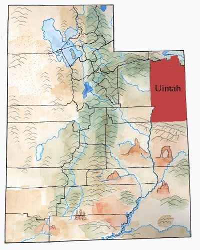
Uintah County, with tall alpine mountains to the north and dry, broken landscape to the south, sits in the Uinta Basin. Part of the Basin lies in western Colorado. The Uinta Mountains form the northern rim of the Basin; the Wasatch Mountains form the western rim; and the Roan and Book cliffs form the southern rim.
Almost a million years ago a prehistoric lake, Uinta Lake, filled the Uinta Basin. During this time, sediment built up on the lake bottom and would later form gilsonite, oil shale, tar sands, and oil.
Today, several rivers or creeks slice across the landscape. The largest, the Green, has cut the deep, remote Desolation Canyon.
First Peoples
Evidence indicates that Paleoindian, Archaic, and Fremont peoples all lived in the Uinta Basin. The Fremont left behind spectacular rock art, especially in Dry Fork Canyon, near Vernal.
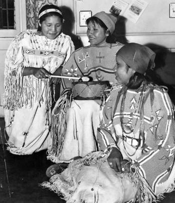
In historic times the Uinta-ats Utes lived in the Basin. The Shoshone also visited there.
Explorers
Fathers Dominguez and Escalante and their party traveled through the Uinta Basin in 1776 as they searched for a route to Monterey, California. In his diary, Escalante referred to the basin as “a fine plain abounding in pasturage and fertile, arable land, provided it were irrigated.”
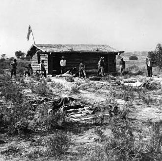
In the 1820s and 1830s American and French trappers found many beaver and other wildlife in the Basin. In 1831-32 Antoine Robidoux, a French trapper, built a small trading post near present-day Whiterocks. Here, trappers could trade their beaver pelts in exchange for supplies. Conflicts with the Utes forced the trappers to abandon the post in 1844.
Anglo-Americans who visited Uintah County include Major John Wesley Powell, who floated down the Green River in 1869 and again in 1871. Captain John C. Fremont led an expedition through the area in the 1840s.
In 1861 Brigham Young sent men to explore the Basin. These men had a different view than Escalante did. They thought the Uinta Basin was just one big wasteland. So Young decided not to send settlers there. Instead, he urged the federal government to send Ute Indians there.
Reservations
Also in 1861, President Abraham Lincoln created the Uintah Indian Reservation. In the 1880s, the Uncompahgre Reservation (now part of the Uintah and Ouray Reservation) was created in the southern part of Uintah County. Utes from Utah and Colorado were forced to move to the reservations.
Settlers
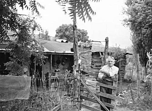
Ashley Valley (where Vernal is) lies outside the reservation. Ranchers and farmers had begun to settle there, and by 1880, the valley had enough people that the territorial legislature created Uintah County, taking most of the land from Wasatch County.
With the building of irrigation canals, other towns took root including Jensen, Maeser, and Tridell.
Gilsonite
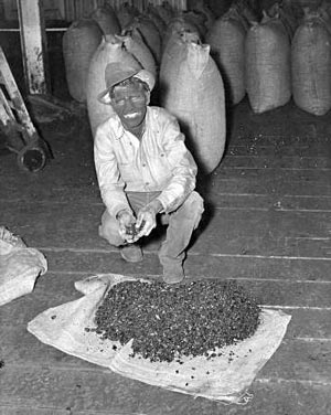
In the 1860s a unique mineral was discovered in the county. In 1888, Samuel Gilson started to promote it as a laquer and insulation for electric wires. (The mineral came to be known as gilsonite, and now used in dozens of products.)
Trouble was, lots of gilsonite lay in the Ute reservations. Men looking to get rich from mining persuaded the federal government to take 7,000 acres from the Uintah Reservation.
This area, called “The Strip,” had no law and order for some time.
In 1898, following an effective campaign by national and local mining interests, the government took Uncompahgre Indian Reservation land away from the Utes and threw it open to outside miners and settlers.
Six years later, the government opened the Uintah Reservation to settlers. The remaining reservation lands in the Basin are a fraction of the originally granted Ute reservation lands and of the Ute Tribe’s traditional homelands.
Dinosaurs
A short distance north of Jensen on the Green River is a famous dinosaur quarry. Earl Douglass, a paleontologist who worked for the Carnegie Museum, first discovered dinosaur bones here in 1909.
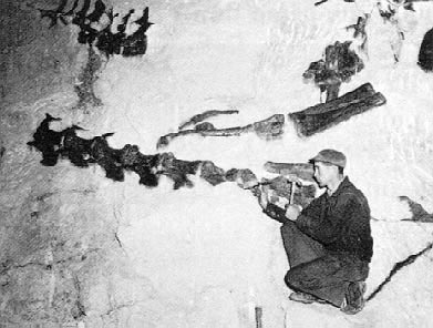
The 150-year-old fossils lay embedded in the Morrison Formation of the Upper Jurassic Age. Paleontologists have found Apatosaurus, Diplodocus, Allosaurus, and Stegosaurus bones here.
In 1915 President Woodrow Wilson created Dinosaur National Monument. Paleontologists still study and work at Dinosaur, and thousands of visitors tour the monument each year.
Economy
Today, Uintah County’s economy relies on farming, ranching, and extraction of oil and gas. Energy prices in the rest of the world have a big effect on the economy of the county.
This has created a boom and bust economy as companies come in to drill for oil and gas, or as they leave. Sometimes the economy is strong, and people pour into the county. And sometimes the economy is not so strong.
Did You Know?
| The first school in the county was a one-room schoolhouse for Ute Indian children built in 1874. |
| In 1886 LDS church president Wilford Woodruff hid out from federal agents looking for polygamists here. He wore a dress and a sunbonnet to go outside and was called “Aunt Matilda.” |
| The county held its first organized rodeo in 1902. |
| In 1909 archaeologists discovered an amazing quarry of dinosaur bones—150 million years old (now protected in Dinosaur National Monument). |
| In 1965 then-Senator Robert F. Kennedy (D-New York) and his wife Ethel visited Vernal. Ethel went shopping in Vernal stores. |
Fast Facts
Area: 4,487 Square Miles
County Seat: Vernal
How it Gots its Name: After the Unita-Ats Utes (the spelling “Uinta without the “h” is used for natural features)
Main Cities/Towns: Vernal, Maeser, Naples
Economy: Cattle, Hay, Alfalfa, Lumber, Oil, Gas, and Shale
Keep Exploring!
Return to the County’s home page here.
Return to the I Love Utah History home page here.